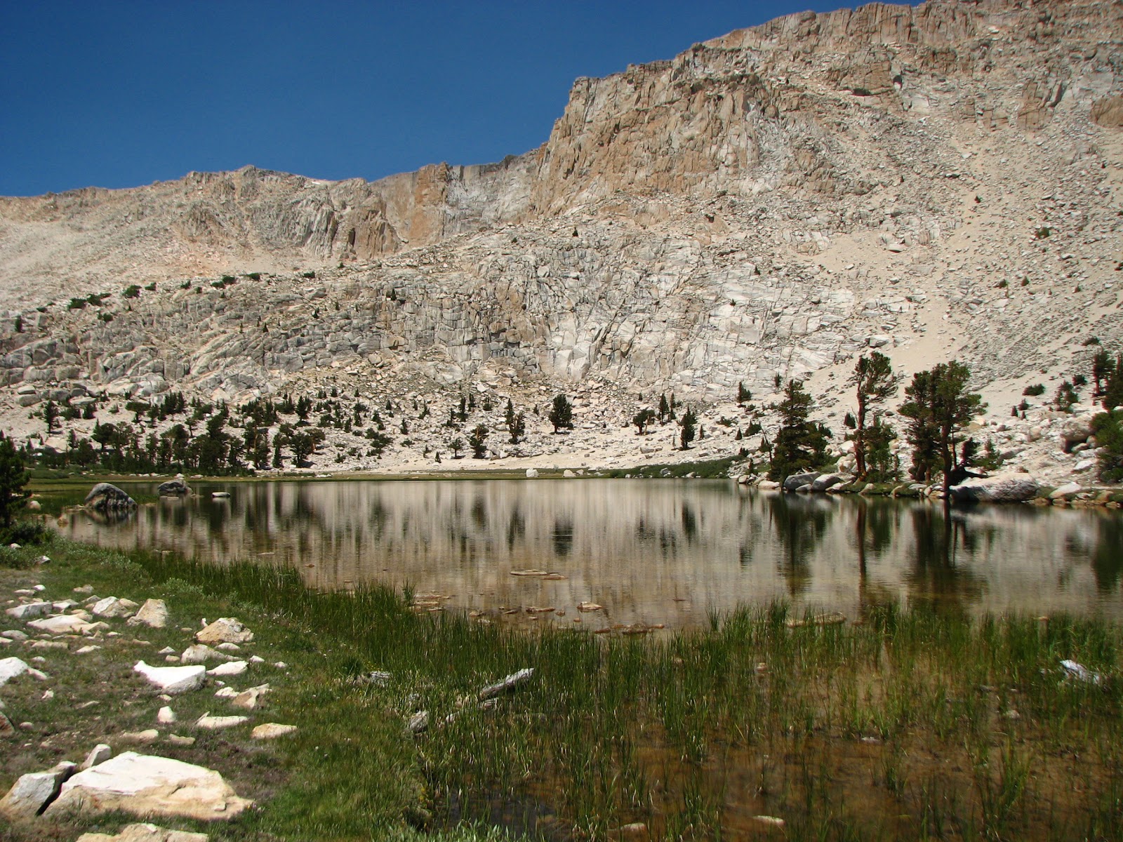
Saturday, August 10, 2013

A High Sierra Adventure (with Scouts) Part 4

From my notes at 18:55 on 2013-07-19
At Soldier Lake


Terrain map showing our start (1) and end points(2) for the day. New Army pass is the red maker ("A"). The hardest portion of the day's hike would be the 1.6 miles (and about 1200 vertical feet) from Long Lake to New Army.


The next morning we were up with the sun. Despite best intentions, we didn't hit the trail until about 08:15. We still needed to get familiar with what it meant to get up, take down the tents, eat breakfast, and finish packing our backpacks. And some of the boys are really not "morning people."

While we ate breakfast I was sneaking looks at John C. to see how he was doing. He actually seemed to relapse a bit after eating, and was complaining of stomach pains. I sat with him and gave him a quiet "rah-rah" speech and told him that I thought he could make it up and over the pass, but let him know that we'd be able to revisit as we went upward.

We finished packing up all our gear, including distributing most of  John's gear amongst the other Scouts and set off at a very deliberate pace. I was determined that we'd take it slow, even if that made some of the stronger Scouts a little impatient. And I was feeling the altitude myself.

Despite our worries about John, we made it up and over New Army Pass ("A" above) from our campsite at Long Lake (1). Although only about 1.6 miles along the trail, we ascended nearly 1200 ft -- according to Google Earth, that's an average slope of nearly 14 degrees. And since we were starting at about 11,160 ft above sea level, the air was pretty thin.

View of the trail upward from just above Long Lake. The trail can be seen extending from lower right to near the center. New Army Pass summit is just to the left of the small (from this perspective) outcropping seen right of center along the ridgeline.

Our first milestone along the way was High Lake, nestled snugly up against a steep slope/cliffs (700-800 ft high) to the north. We took a break and ate a snack before pressing onward and upward.

High Lake and adjacent cliffs
This next portion of the trail was probably the toughest - mostly from a mental standpoint. The wide-open moonscape of rocks and boulders left no illusions about the height of the hill we had to climb. The boys just kept at it -- all of them struggling at least somewhat. Sam even suffered a mild asthma attack at one point - the first one he'd had in over two years. Nathan was a great help, walking along with two of the boys (John C and Gage) who were struggling a bit more. One problem that would get us later was that Gage only had a single 1-quart water bottle - and so Nathan ended up sharing a good deal of his water with Gage.

By 10:30 we estimated we were slightly more than 2/3 of the way up the pass and took a break. It was a little nerve-wracking for me since the boys were not always as careful with where they placed their equipment, or whether they dislodged any rocks. The slope was quite steep -- if  a pack got loose here, it could easily tumble a couple hundred feet down.

John, Gage, and Nathan as we overlook Long Lake(nearest) and Cottonwood Lake #1(farthest).
Now we could see that the summit was getting closer. Recognizing we'd gained that much altitude and knowing we'd done the majority of the hard work seemed to buoy the boys spirits. All through the ascent we'd also benefited from a cool breeze that mitigated the bright sunshine. And then, as the breeze died down, high clouds began to form, which also helped keep us from overheating (see pic below).

View from the trail of the escarpment at New Army Pass. The last remaining bit of snow (which was still feeding High Lake and other) is in the center. You can also see the high clouds and shadowing from them that began forming mid-morning.
As it turned out, we were not far from the summit and reached it by 11:00. What a relief!

The group at New Army Pass
We took another break and ate lunch while taking in the incredible views. Gary and I mapped out the remainder of the day's hike and then I tried to capture some of the scenery. Below are a couple of the better ones:

Sam absorbing the view. Mt Langley is the massive peak filling most of the upper part of the frame.

View to the northwest. There are several peaks in view. From right to left, Joe Devel Pk, then Mt. Pickering is left of center, Mt Newcomb is in the center (just right of the unnamed foreground peak that appears higher), and Mt. Whitney is the highest peak in the distance on the right.
After lunch and some equipment adjustments we headed downhill and into Sequoia National Forest. The trail was moved downward at a reasonable slope, with long switchback segments until we reached the valley below. Soon we'd moved back below treeline and were walking along the path of a small stream. We followed the well-marked trail and had arrived at Soldier Lake by about 1:30. We had to do some reconnoitering to find a campsite - the heavily used spot near the lake had been closed by the Park Service so it could recover. We found a nice spot on the slope above the meadow and the lake thanks to Gary.

The only downside of the spot was its distance from the lake and the outlet stream that we depended on for water. But we sent a few of the boys down to pump water for the group. And that's when our troubles with water filters would begin (and persist through the end of the trip). After waiting a long time for the water party to return, I took a walk down to see what was happening. One of the three filters the boys had brought (all Katydyn Hiker Pros) had broken - somehow the outlet attachment portion had broken off the main body of the pump. And the other pump they were using was very very slow. Sure enough, its filter was heavily contaminated. I cursed the Scouts who'd used it last month for not servicing it, and we swapped the filter cartridge with the broken filter. I figured that would fix the problem since the broken filter was brand new (with a new cartridge). That seemed to fix things.

After dinner (Mac and Cheese for them, Gary and I had pasta with Thai peanut sauce) we discussed the next day's plan. Given that everyone seemed OK (if a bit tired in some cases) I'd decided we should pack up and move the next day to Sky Blue Lake. The option was to do this as a day hike, but I was convinced that once we got there, we'd want to stay. There were a few grumbles but that seemed to work for everyone. Since we only had about 4 miles to cover (although without a marked trail), I figured we could let everyone sleep in a bit.

It looked to me like the trip was working out quite well. We'd made it through a major challenge and were ready to take on the rest of the trip.

Friday, July 26, 2013

A High Sierra Adventure (with Scouts) Part 3

From my notes at 15:15 on 2013-07-18
At Long Lake

Gary B. drove in last night and found us this morning as we were getting ready to the trail. I'd gotten everyone going at 0600, but as usual, it was taking the boys a while to get moving. Finally we got the cars packed up with gear we were leaving behind, disposed of all our extra food, and had the packs ready to go. We began hiking up the sandy, but nicely shaded trail at about 0800. Temperatures in the mid-60's I'd guess, with a light breeze.


Our group ready to hit the trail on Thursday morning at 8 am. Our goal for the day is to make it Long Lake (11,160 ft) from the trailhead (10,070 ft) - a distance of about 6 miles. From left to right: Mitch, Gary, Gage, Sam, Nathan, Daniel, John, and Austin.

As has been typical with our hikes over the past two years, John C. wanted to be out front and set the pace. He moved out relatively quickly and we made good progress. I figured that was OK - and that there'd be the inevitable self-correction. The trailhead is at 10,000 ft and although we'd had the overnight to acclimate, I know I was certainly feeling the effects. As we'll see, the "self-correction" was more than I'd expected.

By 1030, John was struggling. We had hit the first significant climb of our hike at about 0900 - about 1,000 feet over two miles. We were nearly through it, but the sun, dry air, and high altitude had gotten to John. He was flushed, hot, and generally not feeling well. We worked on getting some water and food into him, and let him sit for a bit. One issue that would bug me throughout the trip - John had an internal platypus for water and there is no easy way to monitor his intake of water.

The other boys were mostly doing well, although several were feeling the effects of altitude and/or lack of sleep (common for first few days at altitude). Sam (in particular) complained that he hadn't been able to sleep. We ate lunch (trail mix, luna bars, dark chocolate, peanut butter cheese crackers) and soldiered on.

By 11:30 we'd arrived at Cottonwood Lake #1 (11,041 ft). The trees opened up and gave us our first real vista of the surrounding peaks [PHOTO]. John was still struggling, and we divided up much of his equipment, and Nathan and Gary took turns carrying the pack the final mile plus to Long Lake.
Five-frame mosaic of Cottonwood Lake #1 and surrounding peaks. Mt Langley (14,026 ft) is just left of center. Click here for full-size, zoomable image
Level stretch of trail leading toward Long Lake. New Army Pass looms in the distance, with the summit of Cirque Peak hidden behind trees on the left.


We arrived at Long Lake around 1300 and found a nice, if heavily used campsite at the west end of the lake. After setting up tent and our kitchen/food area, most of the boys went down to the lake to take a dip and fish. We had John lay down in his tent and continued to get him hydrated (including electrolytes).


By mid afternoon, John had recovered sufficiently to take a (short) swim and do some fishing. Everyone was clearly feeling the elevation, and nearly all of us took at least a short nap or a lie-down.


Over at our kitchen area I discovered we had some fearless ground squirrels as neighbors. Managed to shoo them off before they got into our dinner (which was not in the canisters) and hung it up out of their reach. But they were clearly habituated to humans and to our food.

The lake itself is beautiful, nestled at the base of New Army Pass, with a steep escarpment to the north and a view of Cirque Peak to the south. The lake is clear and cold - perfect for cooling off hot feet after the dusty, sandy trail.

Dinner was dehydrated meals (portioned and repackaged) along with hot cocoa and a dessert. Most everyone ate well, although with less relish than usual. John seemed to relapse a bit after dinner. Gage also threw up at one point, although he seemed to bounce back quickly and didn't display other symptoms of altitude sickness.

We kept a close eye on both. I was sufficiently worried to discuss contingency plans with Nathan and Gary that would get John back down to the trailhead. We decided that Plan A was to divide up John's pack and leave him with just the pack, his water, and a few clothing items for the next morning's ascent of New Army Pass. Plan B would have Gary take John along with Gary's son Mitch back to the trailhead, while the rest of us proceeded. Plan C was to take the whole group back.

At this point, it's worth discussing some of the considerations that enter into making decisions in this kind of situation. The first has to do with leadership and experience. As a fairly experienced hiker and backpacker, I needed to draw on past situations and on my formal and informal training (e.g., Red Cross Wilderness First Aid certification, and many hours spent in the mountains of CA and CO). I also needed to be able to recognized my own bias and how vested I was in completing this trip. Remember, I'd gone through all the planning the previous year, only to have the trip fall through. And, just a couple weeks ago, we'd cut short a backpack above Palm Springs (near Mt San Jacinto) because one of the boys had symptoms of altitude sickness).

So, as a type A, goal-oriented person, my tendency is to push through. How then to ensure I'm making a good decision? One of the important things I did was to make sure I wasn't too tired to make good decisions. I'd deliberately minimized my pack load - I didn't carry any of the bear canisters (by far the heaviest items we had) until John faltered. I also had kept to the back of the group and was willing to take it slow when some of the Scouts were pushing up the trail. And I'm familiar with the fatigue and fuzziness of thought that can come with the inevitable hypoxia that comes with going from sea level to 10,000+ feet in a short period of time. So I knew that sitting down and resting and having some uninterrupted time to consider the situation was a necessary part of dealing with the situation.

Finally, I had identified clear, simple options. And once I'd identified those, I was prepared to follow any one of them. If John's (or any other Scout's) condition deteriorated markedly during the night or the next morning as we hiked up the Pass, I had reconciled myself with pulling the trigger on either B or C.

It's this kind of planning that is what I think the Scout motto ("Be Prepared") is really all about.

A High Sierra Adventure (with Scouts) Part 2

From my notes taken at 16:16 on 2013-07-17
At Cottonwood Lakes Trailhead Camp

After a drive to Lone Pine and lunch at the Alabama Hills Cafe and Bakery (large burgers of various types), we drove from Lone Pine up to the Cottonwood Pass trailhead campsite. Horseshoe Meadow Rd (the road to the trailhead) has an impressive view of the Owens Valley below as it switchbacks up an exposed mountain face for about 5000 ft.

Arriving at the trailhead, we chose our specific tent sites. We quickly discovered

  1. Poles to one of the troop tent were broken. Fiberglass pole split along the length. While I had a splint, chances that such a repair would last the trip seemed small.
  2. I had my spare REI Sierra Dome tent - but I didn't bring the poles. <unprintable mutter>
  3. But we did have the spare 3/4 person Coleman troop tent. Austin and Mitch took it.
We got the Scout's tents set up and the campsite organized. Then we did a trial loading up of all our food and equipment for the backpack, including the food. We'd done a pack check on Monday night and I knew that all the scouts could fit a bear canister in their packs, but we didn't have everything ready to go at that time.

I'm glad we did this - it probably saved us an hour or so the next morning. Although Scouts had much of their own equipment, we had to split up:
  • Tents (2 Scouts per tent)
  • Water filters (3)
  • Nalgene Cantenes (3) (large, soft-sided water bottles)
  • Fuel canisters (3 lg, 2 sm) and stoves (3)
  • Bear canisters (5)
  • Food for 1st day's lunch and dinner (not in canisters)

I carried a complete but compact First Aid kit for the group, supplemented by each Scout's individual kit.

We took 5 bear canisters - four Garcia Backpacker Cache and on Bear Vault 450. A listing of the meal plan and food (and fuel) weights can be seen here (opens a separate window). In a future post I'll talk about the meal planning and logistics of packing the food (perhaps the most time-consuming part of the preparations).

After that the Scouts had a couple hours free time. I scouted out the trailheads both outgoing and incoming so that I'd know how to get back to the cars when we came out (the end of our trail was about 0.5 miles south of the beginning trailhead). At 6 pm we started the fire - it took way too long for the hardwood logs I'd brought from home to really get going. But we finally cooked hot dogs and chili (in the can, placed in the coals) and had chips and smores for dessert.  Had just the right number of hot dogs (2 per person) and smores (bag marshmallows, 8 Hershey bars, box graham crackers) but too much chili and chips (3 cans and 2 bags). The food choice was clearly a hit with my audience.

We got everyone in tents by 8:30 pm (stayed light until 9:00 even though the sun had set about an hour before). Ready to hit the trail tomorrow!

Wednesday, July 24, 2013

A High Sierra Adventure (with Scouts)

As part of their Eagle Scout requirements, Troop 23 (Pacific Palisades) has all candidate Scouts take part in a High Sierra backpack. This 5 day, 4 night backpack into a wilderness area helps teach the boys to be able to rely on just themselves and the equipment they carry into the wilderness on their backs. No TV, no video games, no warm beds, and no Mom or Dad to pick up after you. This is usually done when the kids are 13-14, after they've had two and a half years of camping, hiking and overnight backpacking experience.

My group was a bit of a challenge, including my son Sam. We spent winter/spring of 2012 preparing by hiking the Backbone Trail from end-to-end (five 10+ mile hikes and one 20 miler), as well as several backpacks. They were (and are still) a fractious bunch, and not necessarily the best at prioritizing group needs ahead of their own (loudly expressed) desires. Like many teenage boys, they are most interested in the immediate, in their own perspective, and winning any argument with their peers (the more trivial the point, the louder the "discussion").

Snapshot from Google Earth of Backbone Trail. Click here for full size image

For various reasons, that trip fell through. This was our second (and my last) try. Scouting rules require a minimum of two adults - I'd managed to get my eldest (Nathan, 24 and an Eagle Scout) to be willing to come, but last minute bureaucratic paperwork with his job left the outcome in doubt only 4 days before the trip. Another dad (Gary B.) was coming, but had to leave us on the afternoon of the second to last day to meet work commitments. On Monday (7/15) Nathan got OK and we were on. We would have three adults and six Scouts for our trip.

Our detailed itinerary can be seen in my notes (click here).

And below is a Google maps view of our planned backpack - five days above 10,000 feet, 30+ miles of hiking and 6500 vertical feet gained and lost.

Our High Sierra loop. The push pins denote campsites. Our backpack went from Cottonwood Pass Trailhead to the north and west, then proceeded to Long Lake, Soldier Lake, Sky Blue Lake, and Chicken Lake before returning to the trailhead.

The next few blog entries are from my notes taken during the hike and then amplified after our return. Hopefully you'll get a sense of the particular beauty and challenges we all experienced on the trail.